



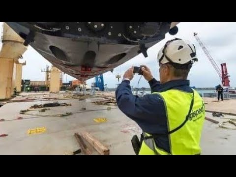
Introduction to Modern Seabed Exploration
The ocean floor remains one of the least explored environments on Earth, yet it plays a critical role in navigation, offshore construction, environmental monitoring, and resource management. To understand and map these underwater landscapes effectively, the industry increasingly relies on Advanced marine survey solutions for Accurate Seabed Mapping.
These technologies combine sonar systems, GPS integration, autonomous vehicles, and high-resolution data processing tools to deliver precise and reliable seabed data. As marine projects become more complex, the demand for accuracy and efficiency continues to grow.
What Are Advanced Marine Survey Solutions?
Advanced Marine Survey Solutions for Accurate Seabed Mapping refer to a set of modern tools and techniques used to capture, analyze, and visualize underwater terrain. These solutions typically include:
- Multibeam and single-beam echo sounders
- Side-scan sonar systems
- LiDAR bathymetry (for shallow waters)
- Autonomous Underwater Vehicles (AUVs)
- Remotely Operated Vehicles (ROVs)
- Real-time kinematic (RTK) GNSS positioning
By combining these technologies, surveyors can create highly detailed 3D models of the seabed, identifying underwater hazards, geological formations, and infrastructure with remarkable precision.
Importance of Accurate Seabed Mapping
Accurate seabed mapping is essential for a wide range of industries, including offshore energy, marine construction, telecommunications, and environmental conservation. Advanced Marine Survey Solutions for Accurate Seabed Mapping enable professionals to:
- Improve navigation safety for ships and submarines
- Plan offshore wind farms and oil platforms efficiently
- Detect underwater obstacles and wrecks
- Monitor coastal erosion and sediment changes
- Support marine biodiversity studies
Without precise mapping, marine operations would face higher risks, increased costs, and reduced operational efficiency.
Key Technologies Behind Marine Survey Systems
The success of Advanced Marine Survey Solutions for Accurate Seabed Mapping depends on the integration of several cutting-edge technologies.
1. Multibeam Sonar Systems
Multibeam sonar emits sound waves in a fan shape beneath a vessel, capturing thousands of depth points per second. This allows surveyors to build detailed bathymetric maps of large areas in a short time.
2. Side-Scan Sonar
Side-scan sonar provides high-resolution images of the seabed surface. It is particularly useful for detecting objects, shipwrecks, and pipeline routes.
3. GNSS Positioning Systems
High-accuracy GNSS ensures that every data point collected is precisely georeferenced. This is critical for aligning underwater data with surface maps.
4. Autonomous Survey Vehicles
AUVs and ROVs allow data collection in deep or hazardous environments where human divers cannot operate safely.
Together, these technologies make Advanced Marine Survey Solutions for Accurate Seabed Mapping highly reliable and efficient.
Applications Across Marine Industries
Modern marine survey systems are widely used across multiple sectors:
Offshore Energy
Wind farms, oil rigs, and tidal energy projects rely on seabed data to select safe and stable installation sites.
Marine Construction
Harbors, bridges, and underwater tunnels require precise seabed analysis before construction begins.
Environmental Monitoring
Scientists use seabed maps to study coral reefs, marine habitats, and ecological changes over time.
Defense and Security
Naval operations depend on accurate underwater terrain data for navigation and strategic planning.
In all these applications, Advanced Marine Survey Solutions for Accurate Seabed Mapping provide the foundation for informed decision-making.
Benefits of Using Advanced Survey Solutions
The adoption of modern marine survey technology brings several key advantages:
- Higher accuracy in depth and terrain mapping
- Faster data collection over large areas
- Reduced operational risks in hazardous waters
- Improved project planning and cost efficiency
- Enhanced data visualization and analysis
These benefits demonstrate why Advanced Marine Survey Solutions for Accurate Seabed Mapping have become an industry standard.
Challenges in Marine Surveying
Despite technological progress, marine surveying still faces challenges such as:
- Harsh and unpredictable sea conditions
- High equipment and operational costs
- Complex data processing requirements
- Limited accessibility in deep or remote areas
However, ongoing innovation continues to improve the reliability and affordability of Advanced Marine Survey Solutions for Accurate Seabed Mapping, making them more accessible to a wider range of industries.
The Future of Marine Survey Technology
The future of seabed mapping lies in automation, artificial intelligence, and real-time data processing. AI-powered systems will soon be able to interpret seabed data instantly, reducing the need for manual analysis. Additionally, cloud-based platforms will allow global teams to collaborate on marine projects in real time.
As these innovations evolve, Advanced Marine Survey Solutions for Accurate Seabed Mapping will become even more precise, efficient, and essential for global maritime operations.
Conclusion
The oceans hold vast potential, but unlocking it requires accurate and reliable data. Advanced Marine Survey Solutions for Accurate Seabed Mapping play a crucial role in ensuring safe navigation, efficient marine construction, and sustainable environmental management.
